


A small aircraft will soon be going around Bengaluru to map the rooftop area available for generation of solar energy. The Bangalore Electricity Supply Company (Bescom) has entered into an agreement with Karnataka Renewable Energy Development Limited (KREDL) and the Centre for Study of Science, Technology and Policy (CSTEP) to build a roadmap to boost the quantum of power generated using solar energy.
The one-year project will see the use of light detection and ranging (LIDAR) technology and is touted as the first such exercise in India.
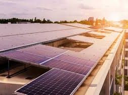
At present, Bescom generates 14.8 MW of solar energy from 524 solar rooftop plants across the eight districts it caters to. But this is woefully short of the target set by the Central and State governments. The target for Bengaluru alone is expected to be one gigawatt (1,000 MW).
“The Ministry of New and Renewable Energy has set a target of 2,300 MW of rooftop PV installations for Karnataka by 2022. If we have to achieve this, we will have to analyse where so much energy can be generated,” said a senior official from Bescom’s Demand Side Management department.
Process of mapping
A helicopter or a small aircraft will fly over the city, sending pulses of light, which will get reflected back from objects on the ground. Receivers will translate this reflected light into data points, which will accurately map buildings, trees, poles, wires and antennae.
“It is basically a sophisticated GIS mapping exercise. LIDAR will be used to create a digital surface model (DSM) for the city. We need to know which rooftop is suitable across various categories – domestic, industrial etc., and also analyse and improve the existing distribution network infrastructure. Solar energy is fluctuating and its impact on distribution transformers has to be studied. Shadow is not a concern for ground-mounted solar plants, but even a small shadow can wreak havoc on generation from rooftop PV plants and destroy the associated business case,” said Saptak Ghosh, research scientist, CSTEP.
Vouching for the accuracy of the digital map, he said even thin cables can be visualised. “Solar geometry calculations will then be carried out to estimate the movement of shadows across the year. The system design will be optimised based on these parameters,” Mr. Ghosh added.
The timeline
The one-year project begins in September. First, tenders will be floated to conduct aerial photography and mapping. Once the vendor is chosen, aerial photographs will be available in four months. As the exercise involves getting clearances from multiple agencies, including the Directorate General of Civil Aviation and the defence establishments in the city, the images are expected to be available for testing by March 2017.
Ranks will be given to each rooftop and the top ones will be chosen for the roadmap.
“By September 2017, the tool will go live along with the roadmap report,” Mr. Ghosh said.
Benefit to consumers
Once the project is completed, consumer will no longer have to look for a consultant to analyse the viability of a solar rooftop plant.
Once CSTEP collaborates with Bescom to analyse consumption of the consumer, it will also analyse the business case for each rooftop based on generation from the shadow-free area.
When consumers pay their bill online, they will find a link that will take them directly to their own rooftop. They will be able to know the extent of shadow-free area available, the amount of solar energy a rooftop plant can generate, and the return on investment (ROI) they can expect.